
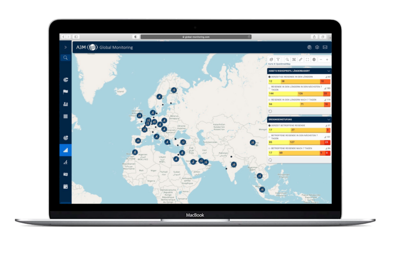
Our team of travel security analysts is staffed around the clock, 365 days a year and uses the latest technology to record events worldwide, which we evaluate and supplement with behavioural advice. We use more than 500 sources of information as a basis, including current travel advice from the German Foreign Office, agency reports, information from the respective embassies, social media, international newspapers, information from weather services on storms, and from research centres on earthquakes and volcanic eruptions.
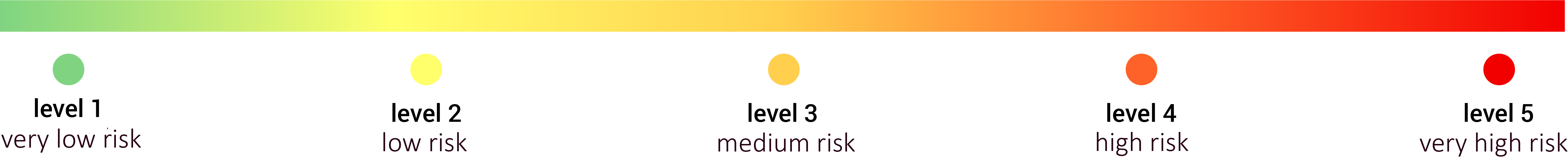
A security rating is performed for each event, which is then ranked on a risk scale from one (very low) to five (very high) and displayed in the system as a warning message with all relevant information on the extent and duration of the event.
The hub of the warning system is a geo-referenced map. The geo-referenced display of symbols and icons on the map provides a quick overview of current events, hazards and crises worldwide. By clicking on the symbol for a hurricane, for example, the user receives further information, e.g. on the trajectory, the expected wind speeds, and where and when it will make landfall.
Various news tickers in the system provide information on current travel and security-related events and updates as well as travel warnings. Country data, information on airports, travel warnings and security advice published by the Federal Foreign Office can also be accessed at any time via special layers.