We continuously keep track of what is happening around the globe!
The world has become more uncertain. Due to increasing globalisation, climate change with the rise of extreme weather phenomena, as well as globalising terrorism and pandemics, it is essential for tour operators and travel managers to continuously keep track of the situation.
Where it all comes together
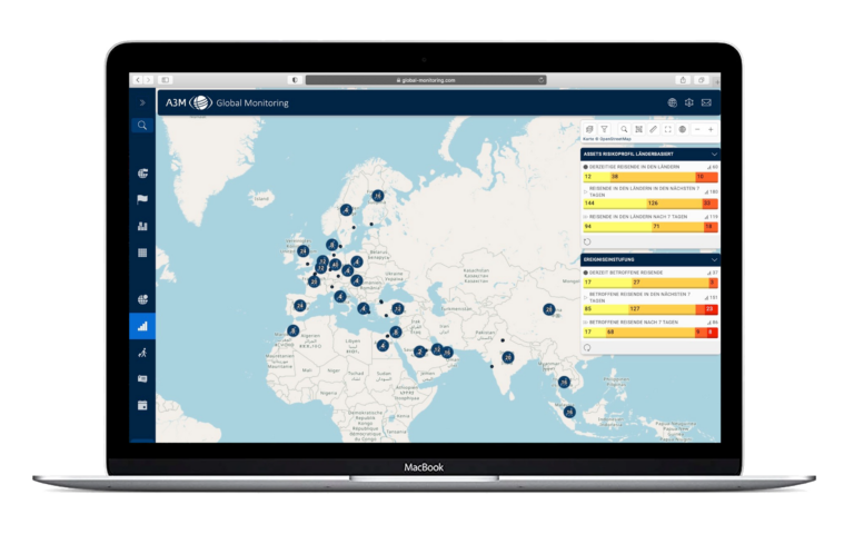
The information system is the core of Global Monitoring. Here, information on hazards and risks worldwide is collected, structured and presented in different layers and modules. Our team of travel security analysts, which is staffed around the clock 365 days a year, uses the latest technology to analyse events worldwide and supplement them with information and behavioural advice. These are displayed in the event ticker. Some of the events are automatically fed into the system via APIs, such as hurricanes, earthquakes or ash clouds. These data are provided directly by scientific institutes such as the National Hurricane Center and the Joint Typhoon Warning Center (for tropical cyclones) as well as Geofon in Potsdam and the United States Geological Survey in the USA (for earthquakes).
In total, we evaluate more than 500 sources of information, including many news agencies and travel and security advice published by foreign offices. Our experts – predominantly political scientists – constantly monitor and evaluate world events and rate them according to the level of security risks.

The events are classified on a risk scale from one (low) to five (very high) and presented in the system as a warning message with all relevant information on the extent and duration of the crisis event.

The events are presented as icons on global OpenStreetMap or Google Maps surface.
Other map and information layers provide additional information such as airports, hotels, webcams, day / night view or the country rating from our Country Information.
Additional modules and layers allow you as a customer to customise how the information is displayed to meet your individual needs:
- In the Destination module, you can have the geographical areas relevant to you displayed in colour.
- In the Situation Room module, you can file your own emerrgency plans in the event of a crisis.
- In the Information Management System, you can create and file your own company-specific event reports as well as situation and crisis reports. If required, these are linked to an event on the map.
- Company-specific contacts and locations are geo-referenced and managed in the Address Book module.
- These company-specific geodata such as addresses, locations, hotels or internal events can then be displayed in their own map layers.

