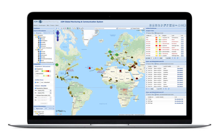
With us you keep the overview for your employees
In an increasingly globalized world, sources of risk and danger have also increased. Be it weather phenomena caused by climate change, political conflicts or globalizing terrorism – business travelers today are exposed to a variety of risks, while at the same time the globalizing economy means that more and more countries and regions are being traveled to worldwide.
Our georeferenced events – The world at a glance
Employers have a great responsibility towards their employees when they are on business trips. Employees must be informed about sources of danger and risks in the run-up to a trip just as much as during their business trip. To increase the safety of your employees, you depend on reliable data and information. This is where we come in with our Global Monitoring System.
Our goal is to ensure that a company in a crisis only has to rely on one external source of information instead of a multitude of sources: Global Monitoring, our core.

 The hub of the warning system is a georeferenced map. The georeferenced display of symbols and icons on the map provides a quick overview of current events, hazards and crises worldwide. By clicking on the symbol for a hurricane, for example, the user receives further information, such as the direction of the storm, the expected wind speeds and where and when it will make landfall.
Various news tickers in the system provide information about current travel- and security-related events and updates as well as travel warnings. Country data, information on airports, travel warnings and security advisories from the German Foreign Office can also be accessed at any time via special layers.
